
What can I even say about the Taliban taking over Afghanistan?
It’s terrible, and a lot of people will die this week, and a lot of people will suffer for decades to come.
Honestly, it’s probably good that Kabul surrendered so quickly. After the Taliban took over Kandahar, Mazar-e Sharif, and Jalalabad (in that order), they controlled all access roads into Kabul, and had the city fully surrounded and ready for an old-fashioned siege. Kabul could have held out for a few weeks or a few months before inevitably falling – at which point the Taliban would be even more angry and murdery than they would have been already. At least this way, more people get to live.
My only connection to Afghanistan is that I liked their cricket team and their national anthem (both of which no longer exist, since the Taliban have banned both sports and music), and even I am heartbroken by this news. I cannot even imagine how horrific this must be for the people who actually live there.
Part of what makes it hard for us to imagine the scale of this tragedy here in the U.S. is that Afghanistan is so far away and seems so mysterious. Even though we have been there for 20 years, we generally know very little about it, even those of us as geography-obsessed as I am. Where exactly is Jalalabad? How far is Bamian from Mazar-e Sharif? How many people live in Kabul?
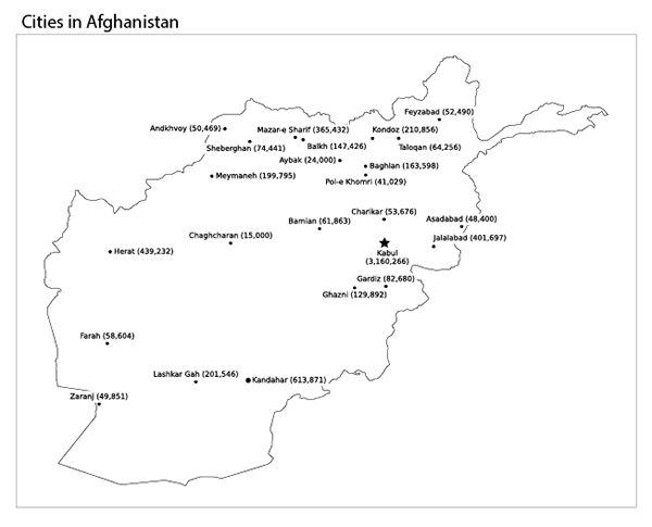
To help us (including me) learn about what Afghanistan is really like, I used the Natural Earth 1:10m geography dataset to make a Python notebook in SciServer to make a simple map of cities in Afghanistan, and their populations. If you’d like to play with the data yourself, comment with your SciServer username and I’ll add you to the research group. I’m also hoping to make a kaggle.com notebook for this work, but something is buggy with Kaggle and it’s not saving the output image files.
Here it is, my map of Afghanistan, with major cities and their populations (click on the image for a larger version):

But that map is still a bit abstract. Great, so Kabul has 3.1 million people, but how many people is that exactly?
A good way to wrap your mind around what these places are like is to compare them to cities you might be more familiar with. That’s what I did in the map below. For each city in the map above, I chose a city in the U.S. with a similar population. Here it is (click on the image for a larger version) – and there some very big cities in Afghanistan.
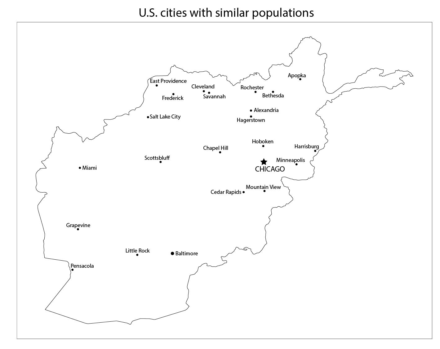
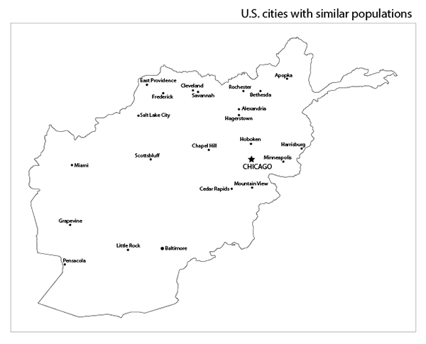
To see it even more clearly, look at the two maps side-by-side. Move the slider in the middle back and forth to switch between the cities in Afghanistan (and their populations), and their U.S. equivalents.
Imagine that you live in one of these American cities – a big one like Chicago or Baltimore, or a smaller one like Apopka, FL or Scottsbluff, NE.
Now imagine that your city has been taken over by the Taliban.