There I fixed it: Ungerrymandering West Virginia

Continuing our gerrymandering series: Almost Heaven…

Suggested new Congressional Districts for West Virginia (red and green), along with the boundary between the official new districts (white). Click for a larger view.

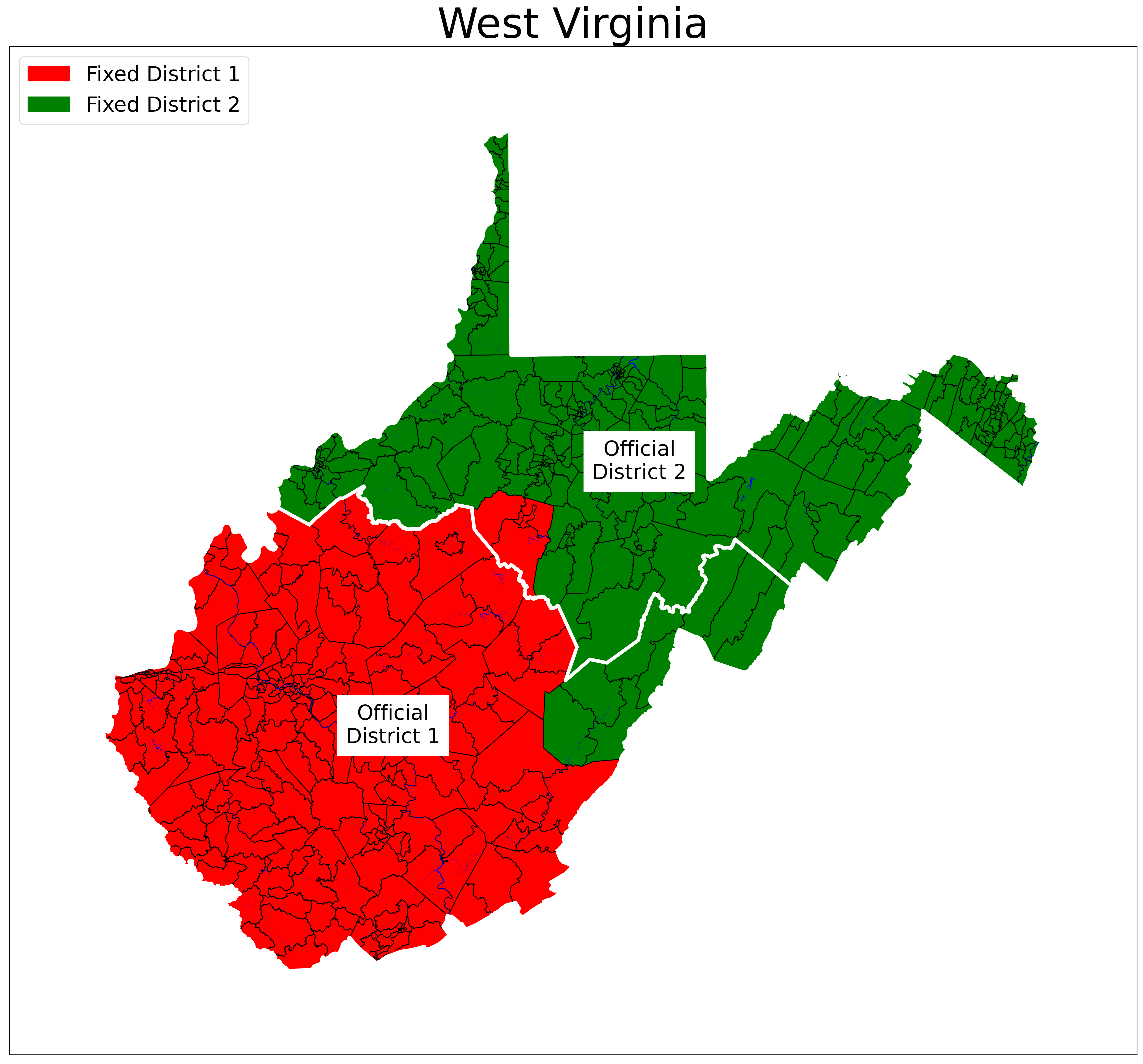
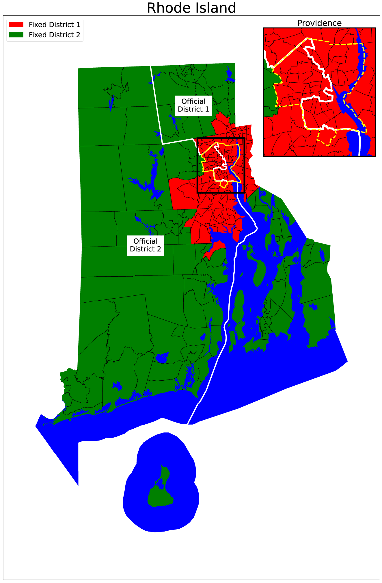
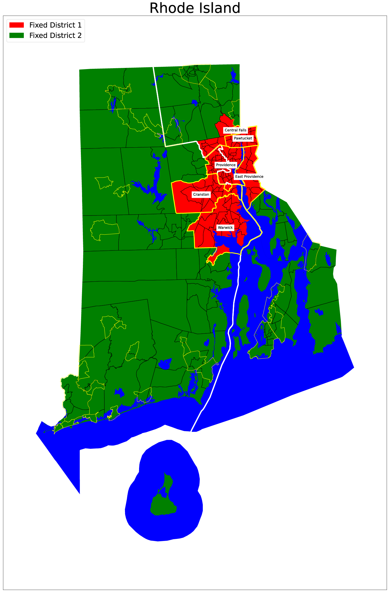
Usual deal with this map: my fixed districts are shown by color: red for District 1 and green for District 2. The white line shows the boundary between the state’s two districts, adopted by the state legislature and signed into law by Republican governor Jim Justice.

Last week, we met the first state in my list to gain a representative in the House: Montana. Today, we meet the first state to lose a representative. West Virginia lost population between 2010 and 2020 – nearly 60,000 people, mostly from moving to other states – and so the state goes from three Congressional districts to two.

There’s not much to say about the strategy for redistricting one of only four states where the majority of the population lives in rural areas. Although Jefferson County at the tip of the Eastern Panhandle is part of the Washington, DC metropolitan statistical area (MSA), the largest MSA mostly within West Virginia is Huntington (+Ashland, Ohio), which ranks 150th in the country; the MSA containing the state capital of Charleston ranks 190th.

Huntington and Charleston both end up in District 1, both by my accounting and by the officially legislated districts. Either way, the district border splits the state in half, north and south. Like the entire state, both districts are heavily Republican, and will produce little drama in the general election this November.

What will be interesting is that the loss of a district means that two sitting representatives – David McKinley (R-WV-1) and Alex Mooney (R-WV-2) must now run against each other in the Republican primary in the northern district. Mooney is a darling of former President Trump, which would seem to make him the favorite, but because of the way the lines got drawn, most of the new district overlaps with the old district that McKinley represented, where is quite popular. So who knows. We’ll find out when the primary happens on Tuesday May 10, 2022.

Ten states fixed, forty to go.

There I fixed it: Ungerrymandering Rhode Island

Continuing my ambitious project to fix the 435 U.S. House districts, today we come to the first state that is obviously, stupidly gerrymandered:

Suggested (colors) and official (white line boundary) new Congressional Districts for Rhode Island. The black box shows the area of the inset around Providence; the yellow line shows the boundary of the city of Providence. Blue areas are water. Click on the image for a larger version.

Why would you have the boundary between your two Congressional districts run right down the middle of the largest city in your state? Ask the Rhode Island state legislature, which approved this new redistricting plan on February 17, 2022. The new districts are nearly identical to the districts used for the last five House elections.

In the map above, notice how the boundary between District 1 (to the right of the white line) and District 2 (to the left) aggressively jumps to the east to split the city of Providence – Rhode Island’s largest city, containing about 20 percent of the population of the state. That jump is even clearer in the inset map of Providence in the top right; compare the district boundary (white) to the city boundary (yellow).

Compare that weirdness with my plan for redistricting Rhode Island. Remember the rules: beginning in the middle of the largest metro area in the state, I start assigning census tracts to a district until that district has accounted for the target population I am looking for: the total population of the state divided by the number of districts. So for Rhode Island, I started in Providence and worked my way out until I had 549,802 people in the district.

The result was that the entirety of the cities of Providence, East Providence, Pawtucket, Warwick, Cranston, and Central Falls are in my District 1, along with several tracts outside of any city just to the north of Providence. This map shows how my fixed districts line up with city borders:

Cities in Fixed District 1 (yellow outlines, with city names labeled)

In all the states I have fixed – and I have far more than I have shown so far – I have tried to keep cities together in the same district, and I have succeeded nearly every time.

With Rhode Island fixed, it’s now nine down, forty-one to go.

The bigger the states get, the more fun the ungerrymandering gets. Stay tuned!