Continuing our gerrymandering series with the the sideboob of the Rockies, the state that’s all up in Idaho’s personal space:
Montana has major reason to celebrate this year. For the past 30 years, they have had only a single representative in the U.S. House, currently Republican Matt Rosendale. Their population has increased enough that they now get a second.
Two Congressional districts means they have to draw them on a map, and mapping districts means the potential for gerrymandering. And the potential for gerrymandering means the potential for me to do it better.
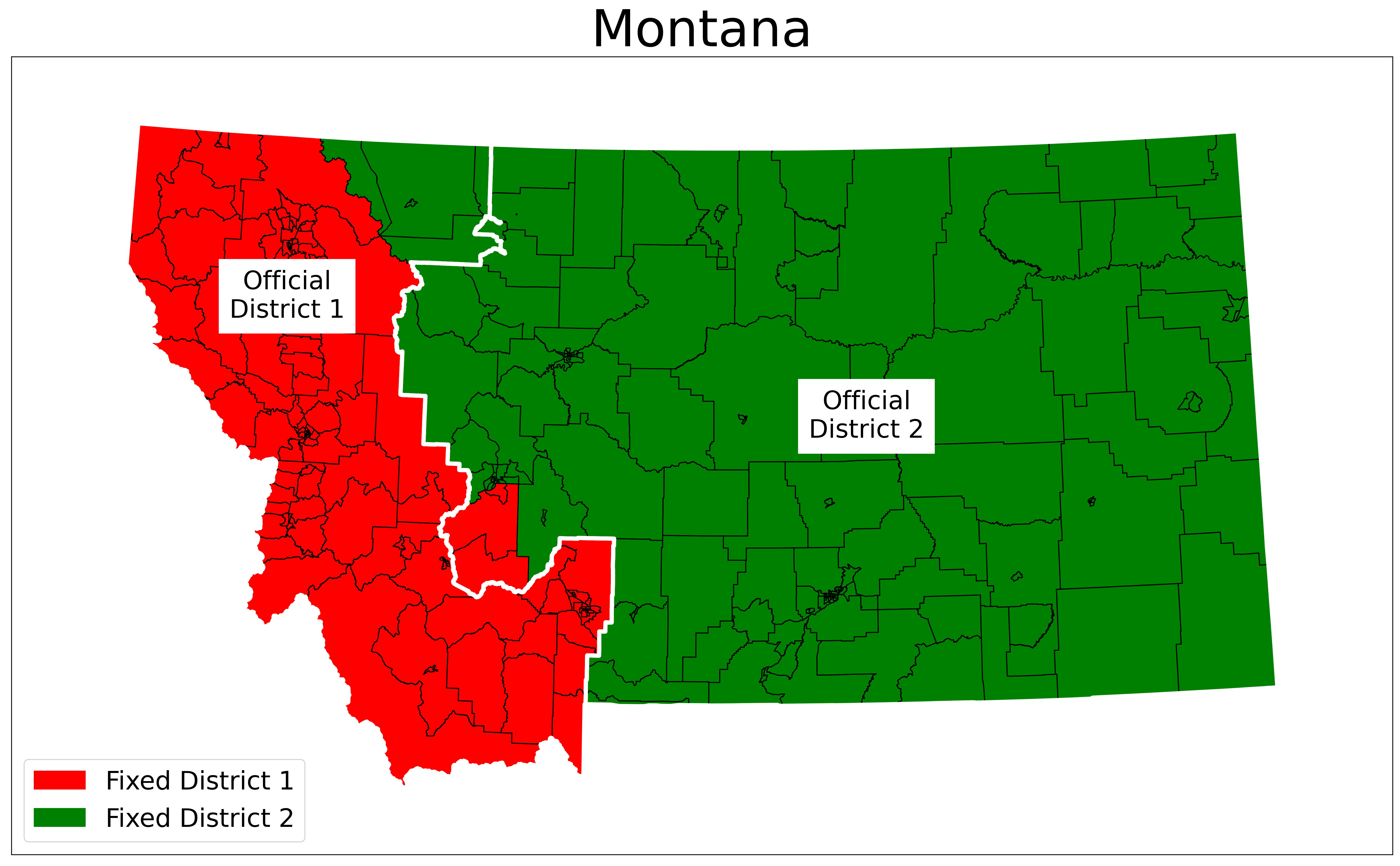
Except I don’t think I did this time. Montana was the easiest state for my arranging of proposed districts; I was able to do it all at the county level. I divided Montana into a western District 1 (red) and an eastern District 2 (green). About 60 percent of the way down the boundary, my District 1 juts to the left, just south of Montana’s capital city of Helena. Helena, and all of Lewis and Clark County, is in District 2 – but Jefferson County immediately to the south is in District 1.
Montana, like Idaho, has a bipartisan independent redistricting committee. Their results are shown with the white dividing line in the image above, with District 1 on the left and District 2 on the right. Notice how their line gives much more space around Helena – I think they did a better job drawing districts than I did.
Don’t worry, that’s unlikely to happen again.
One thought on “There I fixed it: Ungerrymandering Montana”
Comments are closed.