Continuing my ambitious project to fix the 435 U.S. House districts, today we come to the first state that is obviously, stupidly gerrymandered:
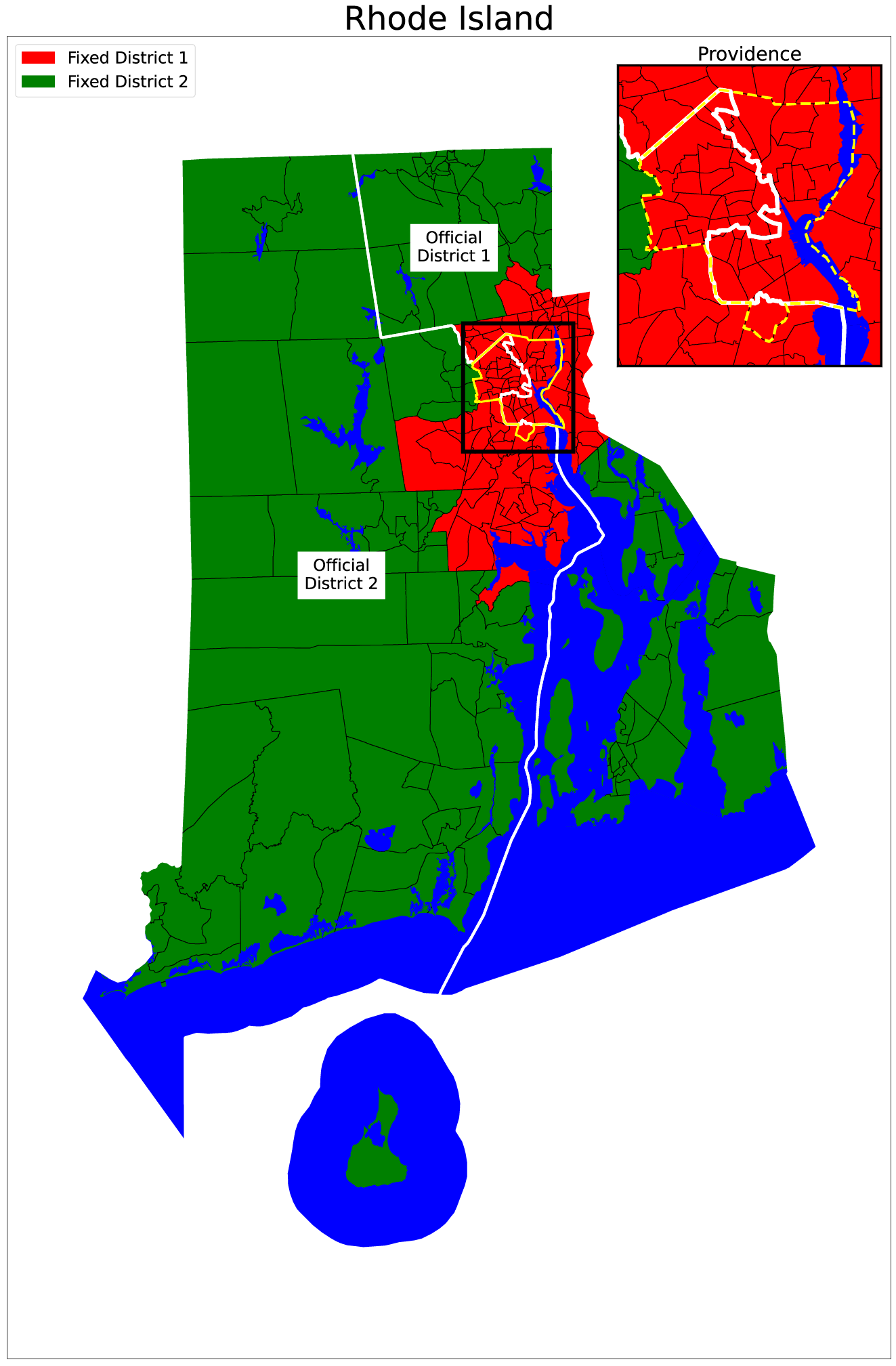
Why would you have the boundary between your two Congressional districts run right down the middle of the largest city in your state? Ask the Rhode Island state legislature, which approved this new redistricting plan on February 17, 2022. The new districts are nearly identical to the districts used for the last five House elections.
In the map above, notice how the boundary between District 1 (to the right of the white line) and District 2 (to the left) aggressively jumps to the east to split the city of Providence – Rhode Island’s largest city, containing about 20 percent of the population of the state. That jump is even clearer in the inset map of Providence in the top right; compare the district boundary (white) to the city boundary (yellow).
Compare that weirdness with my plan for redistricting Rhode Island. Remember the rules: beginning in the middle of the largest metro area in the state, I start assigning census tracts to a district until that district has accounted for the target population I am looking for: the total population of the state divided by the number of districts. So for Rhode Island, I started in Providence and worked my way out until I had 549,802 people in the district.
The result was that the entirety of the cities of Providence, East Providence, Pawtucket, Warwick, Cranston, and Central Falls are in my District 1, along with several tracts outside of any city just to the north of Providence. This map shows how my fixed districts line up with city borders:
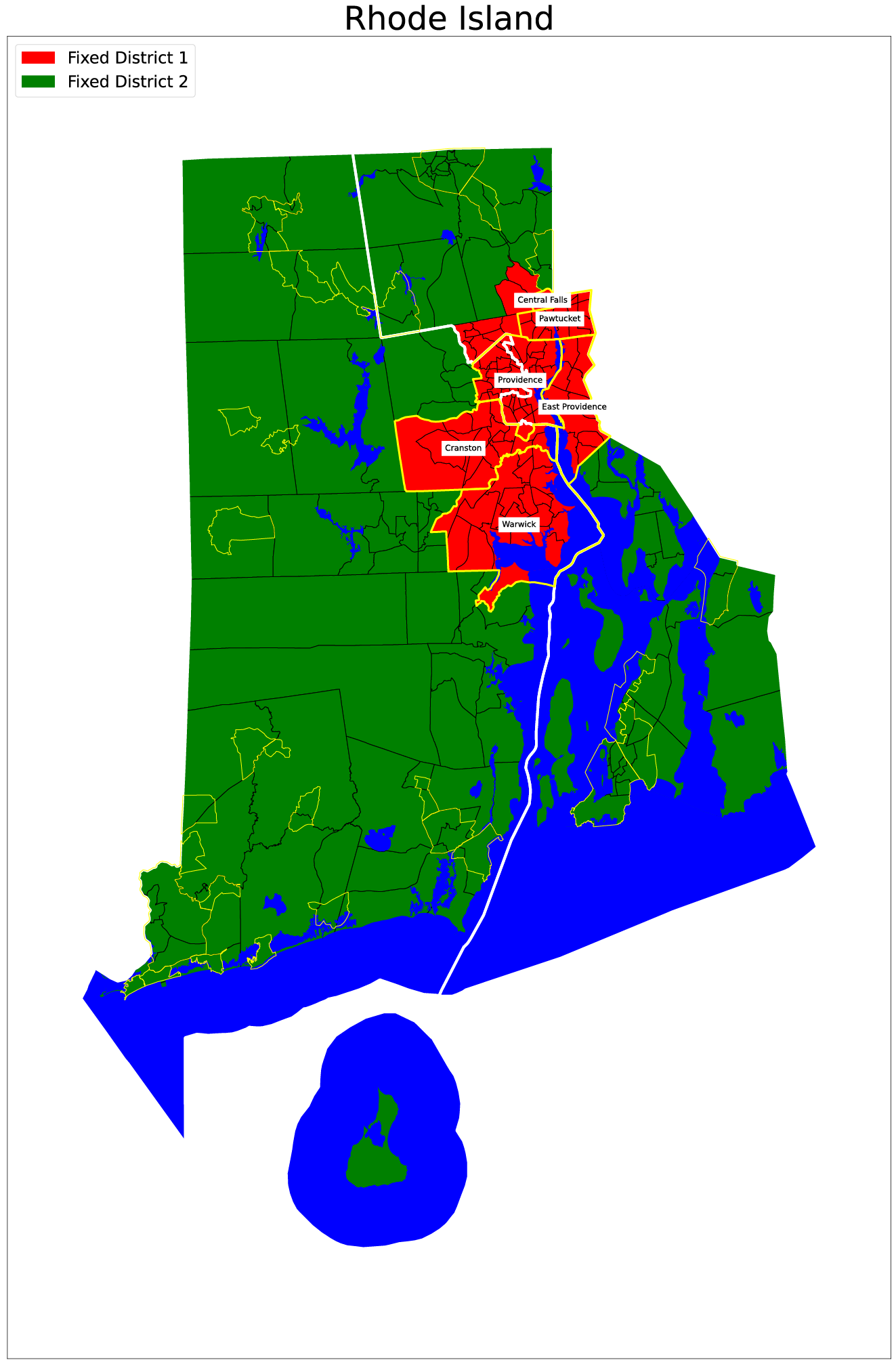
In all the states I have fixed – and I have far more than I have shown so far – I have tried to keep cities together in the same district, and I have succeeded nearly every time.
With Rhode Island fixed, it’s now nine down, forty-one to go.
The bigger the states get, the more fun the ungerrymandering gets. Stay tuned!