And so we arrive at the first state with four Congressional districts: Arkansas. The map is below. My attempt at fair districts are show by colors, and the official districts are divided by pink lines with labels. A fourth district requires a fourth color: I chose cyan (light blue). I love this color scheme by the way.
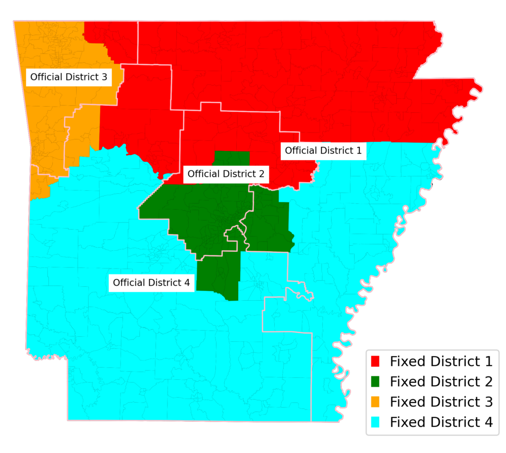
My approach has always been to start in the middle of the largest city (in the case of Arkansas, Little Rock) and move outwards, adding counties or census tracts one at a time until the district’s population gets close to (total state population / number of districts) – in the case of Arkansas, until each district has approximately 750,000 people. Normally I would name the place where I started “District 1,” but in this case, I went with District 2 to match the fact that the official district of Little Rock is 2.
When District 2 had enough people, I moved on to the next largest urban area: northwest Arkansas, home to the cities of Bentonville, Fayetteville, and Fort Smith, which I called District 3. The next largest urban area is Jonesboro in the northeast, which I filled up and called District 1. And then the remainder of the state became District 4.
The official districts to my hopefully-fair districts. Fort Smith is officially in District 4, while I had it in District 3 with the other Northwest Arkansas cities. I was expecting the official district boundaries to split up Little Rock, so I was surprised that they didn’t. Little Rock is entirely within official District 2, as well as my District 2.
What that means is that Arkansas is fairly districted. That obviously won’t be the case for every state.
Up next: Iowa
Previous ungerrymanders:
Introduction
Idaho
Montana
Rhode Island
West Virginia
New Hampshire (and again)
Maine
Hawaii
Nebraska
New Mexico